
Garmin ECHOMAP Ultra 2 12-Inch 126sv Chartplotter
4.9Editor score
Multi-band GPS accuracy
Wireless network sharing
Screen recording capture
Chartplotters for offshore fishing combine detailed navigation with powerful sonar to guide you to productive waters. These devices help anglers locate structures and hazards while providing precise positioning for safe travel in open seas.
We evaluated ten leading models based on display clarity, sonar range, mapping features, and system compatibility. Each product offers unique strengths for different vessel sizes and fishing styles, from coastal trips to deep-sea expeditions.
This list presents top picks for various budgets and needs. Each review highlights key specs and real-world performance. Keep in mind that retail prices can vary by region and time.
4.9Editor score

4.7Editor score

4.5Editor score
As an Amazon Associate we earn from qualifying purchases.
The following table provides a quick side-by-side comparison of key features across all ten models to help you identify the right fit for your offshore needs.




The Humminbird XPLORE Series stands out as a top contender for offshore anglers seeking precision navigation and sonar. Its 4.7-star rating reflects consistent satisfaction with its dual imaging capabilities and user-friendly interface.
We may earn a commission when you buy through this link, at no additional cost to you.
MEGA Side Imaging+ provides clear views of structures and fish up to 200 feet on each side. This detail helps locate wrecks and reefs efficiently. The AutoChart Live feature maps real-time contours and vegetation, making it easy to log productive spots.
While the 10-inch screen is bright and responsive, some users may need time to master the full feature set. The control head-only option means checking transducer compatibility before purchase to avoid extra costs.
This model suits serious offshore anglers who value mapping customization and wide-area scanning. Its integration options and reliable sonar make it a robust choice for long trips.
AutoChart Live records up to eight hours of data to map bottom hardness and depth contours automatically.
Built-in NMEA 2000 networking allows connection to other boat electronics for a unified system.
We may earn a commission when you buy through this link, at no additional cost to you.
The Garmin ECHOMAP UHD2 94sv combines a bright 9-inch display with essential mapping tools. Its 4.7 rating highlights reliability for both navigation and traditional sonar use.
We may earn a commission when you buy through this link, at no additional cost to you.
Included GT56 transducer enables traditional, ClearVü, and SideVü scanning right out of the box. Preloaded Navionics+ charts provide detailed US coastal data. Wi-Fi connectivity simplifies sharing sonar images between units.
Some anglers find the 9-inch screen less ideal for complex multi-window setups. The transducer range is standard but may not reach the depths some offshore fishermen require.
This unit fits recreational offshore trips where ease of setup and clear visuals matter. It offers strong value with included hardware and solid mapping support.
The GT56 transducer supports multiple scanning modes to reduce initial hardware costs.
Sonar and waypoints share wirelessly between compatible ECHOMAP units for crew collaboration.
We may earn a commission when you buy through this link, at no additional cost to you.
The Simrad NSS 4 delivers top-tier performance with its 8-core processor and SolarMAX display. Rated 4.6 stars, it appeals to cruisers needing speed and precise control.
We may earn a commission when you buy through this link, at no additional cost to you.
Active Imaging HD support and built-in CHIRP sonar improve target separation. C-MAP DISCOVER X maps enhance navigation depth. The interface allows pinning apps for quick access to critical functions.
The premium price includes advanced features some may not use immediately. Fishcast data is useful but depends on a recurring subscription, adding ongoing costs.
This plotter suits serious boaters demanding fast processing and integrated ecosystem support. Its control options and display quality justify the investment for many professionals.
The Qualcomm 8-core processor enables faster updates and seamless transitions between menus.
Fishcast by ROFFS delivers top-ranked offshore hotspots based on fishing data trends.
We may earn a commission when you buy through this link, at no additional cost to you.
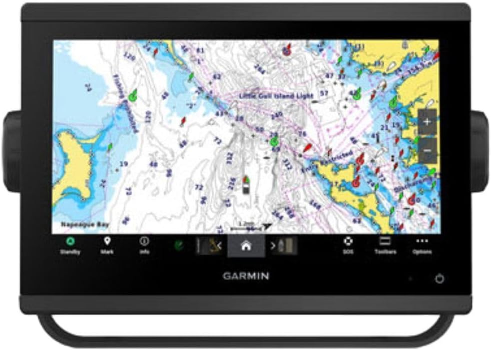
The Garmin ECHOMAP Ultra 2 126sv stands as a premium choice with its 12-inch display. A 4.9 rating highlights its excellence in navigation accuracy and connectivity features.
We may earn a commission when you buy through this link, at no additional cost to you.
Multi-band GPS improves position stability when signals are weak. Wireless sharing of sonar and routes simplifies coordination. The screen recording feature allows users to capture moments directly from the display.
The high price reflects advanced capabilities but excludes transducers. The unit demands sufficient console space, which may not suit smaller vessels.
This model suits captains prioritizing accuracy and visual clarity. Its large screen and networking tools make it ideal for complex offshore operations.
Multi-band GPS provides improved positioning accuracy in challenging offshore environments.
Wireless sharing allows crew to exchange waypoints and sonar data instantly.
We may earn a commission when you buy through this link, at no additional cost to you.
The Simrad GO9 serves as a versatile multifunction display ideal for adding navigation to sportboats. With a 4.4 rating, it balances performance with expandability.
We may earn a commission when you buy through this link, at no additional cost to you.
Included HDI transducer offers clear bottom structure views. The C-MAP DISCOVER card includes vector charts and tidal data. Mirroring allows access to radar and charts on smartphones.
While robust, the 9-inch screen may feel small for split-view setups. Advanced users might find initial configuration time-consuming.
This unit fits small-to-mid vessels seeking expandable systems. Its transducer and mapping inclusion reduce upfront hardware needs for new setups.
The GO9 supports navigation, sonar, and radar integration on one platform.
Display mirroring lets crew view charts and radar on tablets throughout the vessel.
We may earn a commission when you buy through this link, at no additional cost to you.
This bundle combines the Garmin ECHOMAP Ultra 2 10-inch unit with LiveScope Plus technology. Rated 4.4, it targets anglers needing live underwater views.
We may earn a commission when you buy through this link, at no additional cost to you.
LiveScope Plus displays real-time sonar images allowing anglers to see fish movement. The bright display ensures visibility under the sun. Color palettes are vivid for distinguishing structures.
The bundle price includes transducer costs but remains higher than standard units. LiveScope requires careful mounting to ensure clear transmission.
This package suits active offshore anglers chasing moving targets. The live imaging technology offers distinct advantages in spotting fish and structure.
LiveScope Plus delivers real-time sonar views to visualize fish movement instantly.
High-contrast color palettes enhance detail visibility in varying lighting conditions.
We may earn a commission when you buy through this link, at no additional cost to you.
The Garmin GPSMAP 943xsv emphasizes high-definition scanning sonar capabilities. With a 4.7 rating, it is trusted for detail and optical performance.
We may earn a commission when you buy through this link, at no additional cost to you.
Ultra HD scanning sonar reveals fish and structure with clarity. Panoptix compatibility allows additional sonar modes. Pre-loaded mapping ensures you can start navigating immediately.
To maximize performance, the correct transducer is necessary, adding to overall cost. This unit suits those prioritizing image resolution over basic functionality.
Ideal for anglers needing precision imaging, this plotter offers strong optical and sonar quality. Its Panoptix support makes it future-ready for advanced setups.
Ultra HD scanning sonar produces sharp images for detailed structure analysis.
Improved display optics ensure readable maps even in bright offshore conditions.
We may earn a commission when you buy through this link, at no additional cost to you.
The Humminbird Helix 5 Chirp GPS G3 offers essential chartplotter features at a budget-friendly price. Rated 4.5, it balances affordability with performance.
We may earn a commission when you buy through this link, at no additional cost to you.
Dual Spectrum CHIRP provides clear fish views with Wide and Narrow modes. The included Basemap covers coastal regions. AutoChart Live records data to generate custom maps.
Keypad controls are reliable in bad weather but slower than touchscreens. The compact display may limit multi-window usage on complex trips.
This unit fits anglers prioritizing sonar over advanced navigation. Its mapping and sonar value make it an excellent entry point.
Dual Spectrum CHIRP delivers detailed fish arches and target separation.
Softkey keypad controls ensure operation regardless of weather or wet conditions.
We may earn a commission when you buy through this link, at no additional cost to you.
The Simrad NSS Evo3S provides robust performance with its SolarMAX display and iMX 8 processor. Rated 4.4, it supports extensive system integration.
We may earn a commission when you buy through this link, at no additional cost to you.
The high-definition display remains legible in direct sunlight. C-MAP maps include enhanced US data. VESSEL-WIDE integration allows monitoring engines and fuel efficiency.
Smaller screens like the 9-inch may limit map scale options. Advanced users benefit most from the processing power.
This plotter suits cruisers needing system-wide monitoring. Its display quality and processor speed support demanding offshore navigation tasks.
SolarMAX IPS displays ensure clear visibility even under direct sunlight exposure.
VESSEL-WIDE integration supports engine monitoring and onboard sound control.
We may earn a commission when you buy through this link, at no additional cost to you.
The Garmin ECHOMAP UHD2 53CV offers a compact and affordable solution for coastal fishing. With a 4.5 rating, it provides reliable dual scanning sonar.
We may earn a commission when you buy through this link, at no additional cost to you.
CHIRP traditional and ClearVü sonars deliver clear bottom views. Preloaded Navionics maps support inland and nearshore routes. Wi-Fi simplifies sharing waypoints with other units.
The 5-inch screen is small for complex offshore routes. Its sonar depth is best for shallow waters.
This unit suits small boat anglers seeking affordable sonar. It is an ideal starting point for beginners.
Dual CHIRP and ClearVü sonars provide clear images of structure and fish.
A compact design and low cost make this ideal for entry-level buyers.
We may earn a commission when you buy through this link, at no additional cost to you.
Selecting the right chartplotter requires evaluating display, sonar, and mapping to match your vessel and fishing goals.
Display size affects how much information you can view at once. Larger screens help with split views but require more space. Look for sunlight-readable displays like SolarMAX to ensure visibility during bright conditions.
Prioritize high resolution and sunlight readability to maintain accuracy during daylight offshore trips.
Offshore fishing demands high-range sonar to locate fish far below. Features like CHIRP, Side Imaging, and LiveScope provide detailed underwater images. Ensure your model supports the required transducer depth.
Choose units with wide-range side scanning and clear target separation for efficient offshore structure mapping.
Preloaded maps save setup time. Coastal coverage ensures accuracy near shorelines. Look for AutoChart or similar tools that create custom depth maps during your trips.
Ensure the included map card covers your primary fishing regions to avoid missing data points.
Wi-Fi, Ethernet, and NMEA 2000 ports allow integration with other boat electronics. Wireless sharing simplifies crew coordination. Compatibility with trolling motors adds convenience during anchoring.
Select models with NMEA 2000 support for seamless integration with radar and engine sensors.
Touchscreens are intuitive but may fail in wet conditions. Keypads and rotary dials offer reliable backup. Hybrid controls give flexibility in varying offshore weather.
Look for units combining touch and physical controls for reliable operation in harsh environments.
Chartplotter costs vary widely based on size and features. Entry units are affordable but lack advanced sonar. Premium models offer live imaging but need extra budget for accessories.
Balance initial hardware costs against the value of included transducers and map cards to avoid hidden expenses.
Sticking with one brand simplifies integration. Garmin and Simrad offer broad networks for sharing data. Check compatibility with existing sensors to avoid wiring issues.
Verify the brand supports your existing motor and engine data systems before purchasing.
Offshore conditions demand water-resistant hardware. Look for warranties covering screen and internal failures. Units designed for marine environments will last longer under stress.
Choose models with robust build ratings to withstand saltwater exposure and vibration.
Install the chartplotter securely using the mounting brackets provided. Ensure the wiring meets marine standards to handle vibration and corrosion. Calibrate the GPS and compass at the dock before heading out.
Set up your waypoints and routes while in port to save battery and time. Use the touchscreen or keypad to mark depth contours as you fish. Regularly update your map cards for accurate navigation data.
Protect the screen with a sunshade when not in use to reduce glare. Clean the unit with a soft cloth and mild marine-safe cleaner to remove salt residue. Check firmware updates annually for performance improvements.
For offshore fishing, a 10-inch or larger display is recommended. Larger screens allow split views of sonar and maps simultaneously. Compact units can work on smaller boats but may limit navigation detail.
Many models include a transducer, but offshore versions often require specific high-depth units. Check the product specs to confirm transducer compatibility before purchase.
Yes, chartplotters function without mobile internet by using preloaded maps and GPS. Some features like weather updates may require an active connection or subscription service.
Map updates are typically handled via Wi-Fi or an SD card. Connect your unit to a network and use the vendor's app to download the latest chart data.
CHIRP sonar sweeps a range of frequencies to provide clearer target separation. Traditional sonar uses a single frequency. CHIRP is better for distinguishing fish from bottom structure.
Most marine chartplotters are rated water-resistant for splash exposure. However, they are not fully submersible. Use protective covers during heavy rain or rough seas.
This guide highlights top performers ranging from budget-friendly Helix 5 models to premium ECHOMAP Ultra 2 units. Each picks balances display size, sonar quality, and mapping features.
Focus on units offering wide-range imaging and reliable GPS accuracy. Connectivity options are critical for integration with your existing boat systems.
Always verify current availability and pricing before purchasing to ensure the model meets your specific offshore needs.